The Buffer Zone Across the Island
The Green Line today is not simply a line drawn through Nicosia but a buffer zone between two states, the Turkish Cypriot north and Greek Cypriot south.
It is described as a demilitarized zone where........"its northern and southern limits are the lines where the belligerents stood following the ceasefire of 16 August 1974, as recorded by UNFICYP."
This zone (including the Kokkina enclave) is over 180kms long. It is 7.4 km at its widest and 3.3 m at its narrowest point.
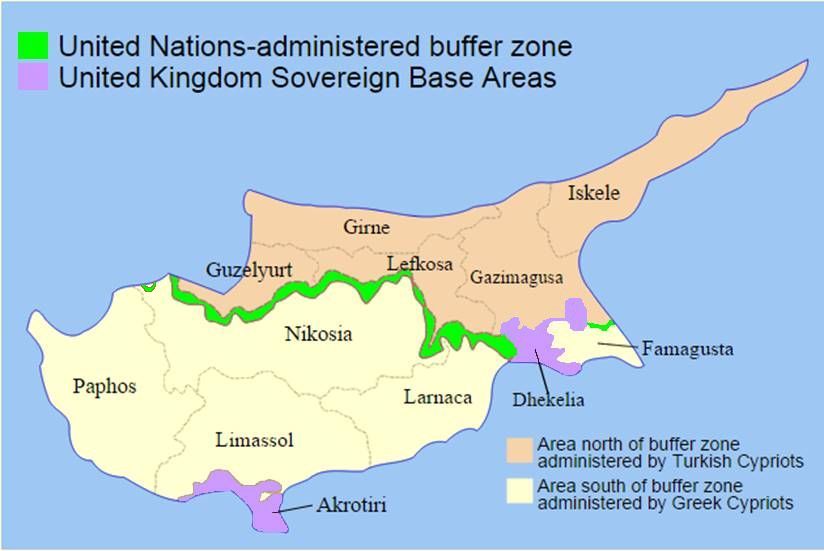
The Green Line/Buffer Zone occupies 346 square kilometres or 3.7% of the total area of Cyprus
The zone exists to prevent renewed hostilities between the opposing forces in the Cyprus conflict. Some areas are totally "out of bounds" as thousands of landmines still lie dormant between the de facto ceasefire lines. In the first seven years of the clearance project over 27,000 land mines were removed from the buffer zone, 81 minefields were declared mine free and almost 11 km² of land has been returned to its original use.
The work continues.
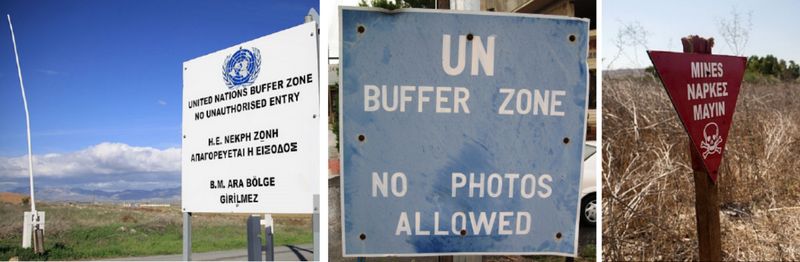
A variety of signs indicating the Buffer Zone and the dangers that lie within
Access to other parts is less strictly controlled but prior approval is required from the UN before any activity takes place.
A permit scheme, for both the Greek and Turkish sides, exists for construction, farming, work and access.
It is quite posible to see fields close to each other being tended by Turkish and Greek Cypriot farmers.
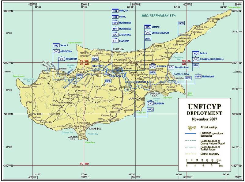
A map showing the distribution of responsibilities for the three sectors of Cyprus as of 2007 (click for a larger version in a new window)
Although many positions (Greek/Turkish/UN) are no longer manned, as you explore the area, there is a real sense of being observed.
When tensions were high a very large number of troops and resources were committed to monitoring the Buffer Zone.
It would have been virtually impossible to approach the zone without being observed and challenged.
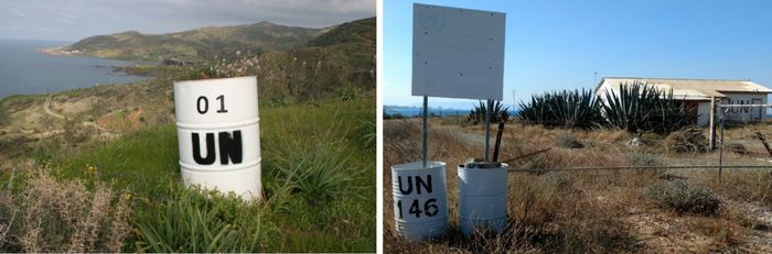
The first and the last of the many UN OPs that are positioned along the length of the Buffer Zone (Pachyammos to Famagusta)
The maps in the "Across the Island" section show the route of the Green Line across the island with the details divided into ten sections.
In Spring 2017, the author and his wife followed the entire length of the Green Line to capture a flavour of the geography and the way of life in and around the Buffer Zone.
In Spring 2018, the author and his wife tried the same exercise but from the north side and with very different results.