The Louroujina Pocket
Map 6......From east of Geri to the ESBA (Eastern Sovereign Base Area)
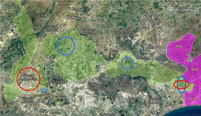
From L to R......The Turkish village of Akincilar (Louroujina), the Greek towns of Athienou and Troulloi (both of which are in the Buffer Zone).
Pyla (the island's only remaining mixed village) and the ESBA at Dhekelia.
Due to the last minute push by the Turkish army to reach Akincilar, the Buffer Zone follows a convoluted path.
The images for this section begin at the "pinch point" in the Buffer Zone at the top left of the map.
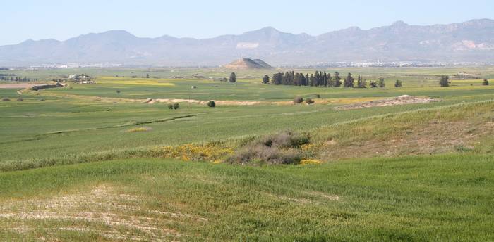
Looking NNW towards the Kyrenia mountains and the Turkish Cypriot flag. The twin "pyramid" hills (slightly lower) were seen in an earlier photograph viewed from the other side and bearing a smaller version of the flag
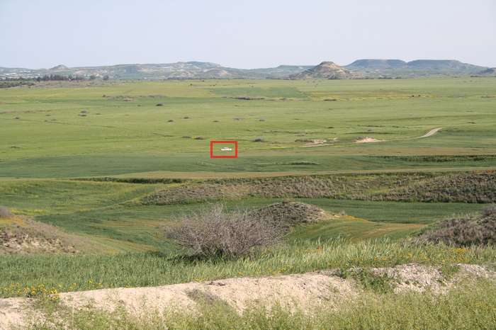
The deep anti-tank trench lines can be seen crossing the centre of the photograph
Looking SE with a UN vehicle patrolling the Buffer Zone
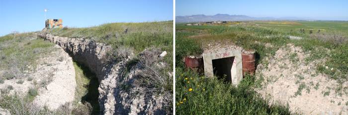
The ridge overlooking the Buffer Zone is a maze of trench systems, OPs and bunkers
A video overlooking the Buffer Zone taken from the defensive lines on the ridge
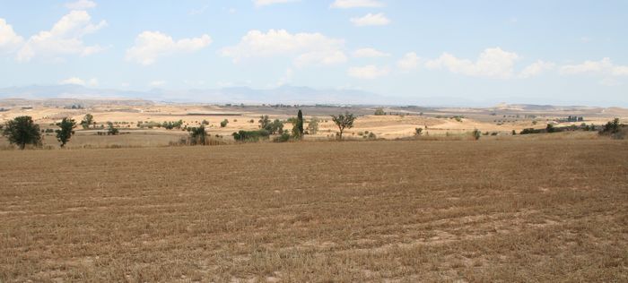
A few weeks later the countryside is now brown. This view of the Buffer Zone is east of Pera Chorio with the high ground near Akincilar visible at the RHS
The UN patrol road is visible crossing the centre of the image
At the start of the video you can see a UN camp and then the Buffer Zone close to Pera Chorio (visible in the distance)
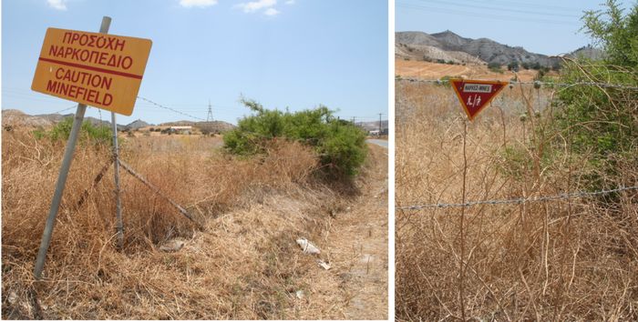
En route to Lympia the A2 motorway and B2 main road pass through the Buffer Zone.
I was surprised to see these signs at the edge of the B2
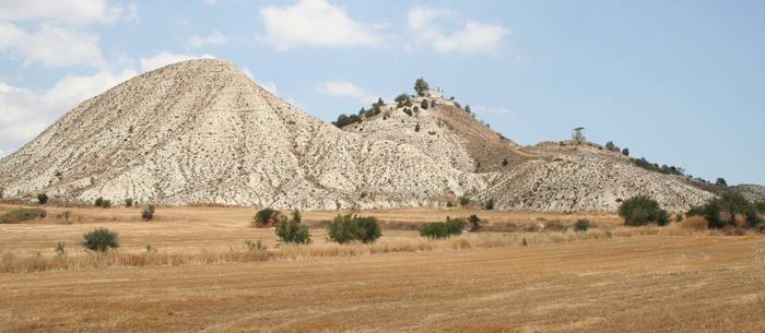
Approaching Lympia, the Church of the Holy Cross marks the forward Turkish position
The fields in front of the ridge are in the Buffer Zone and the Turkish positions are on top of the high ground
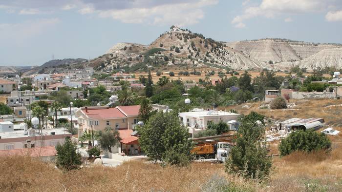
The village of Lympia is partially located within the Buffer Zone (the Holy Cross Church is top centre)
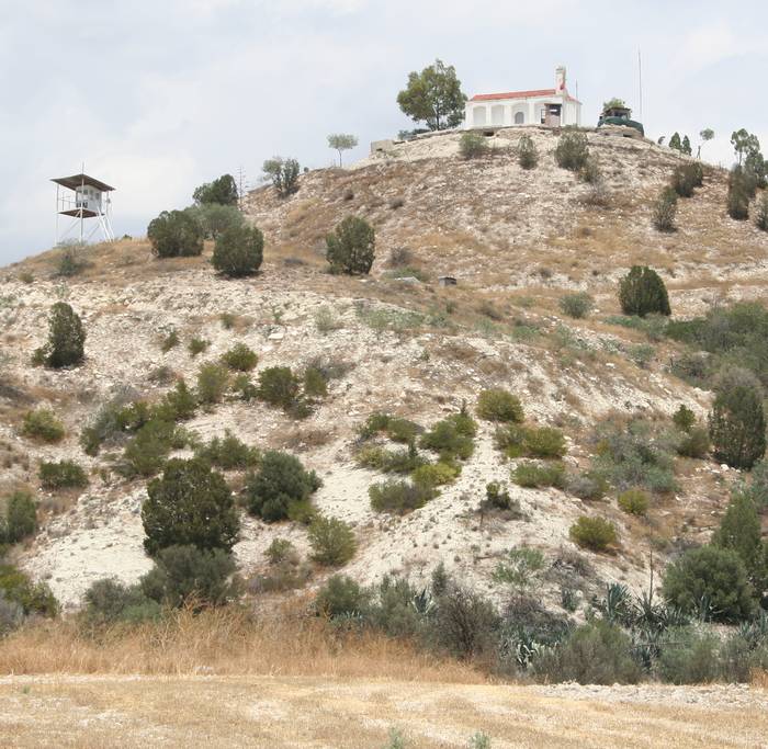
The Turkish position looms over the village like a medieval fortification
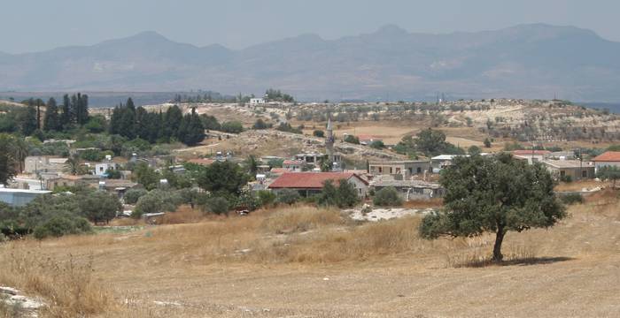
The large Turkish Cypriot village of Akincilar north of Lympia
The video is taken in the Buffer Zone at the northern part of Lympia......the Turkish village of Akincilar can be seen as well as the Church of the Holy Cross
At this point the shape of the Buffer Zone is similar to the letter 'U' with the viewer at the base