The Buffer Zone Villages
Map 6......From east of Geri to the ESBA (Eastern Sovereign Base Area)
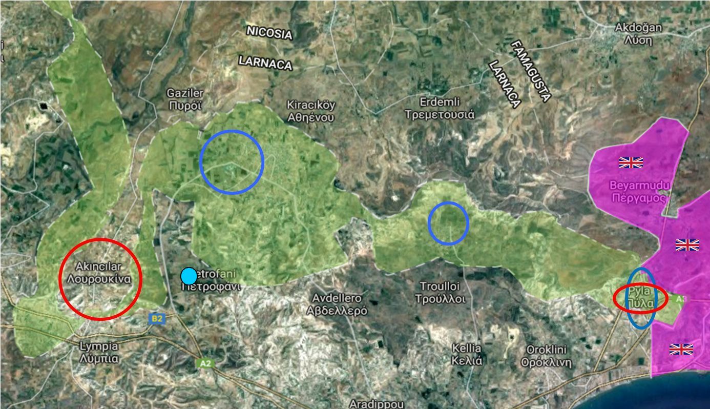
From L to R......The Turkish village of Louroujina, the Vougies high ground, the Greek towns of Athienou and Troulloi (both of which are in the Buffer Zone).
Pyla (the island's only remaining mixed village) and the ESBA at Dhekelia.
As the Louroujina pocket pushes the Buffer Zone to the south, a similar pocket pushes the zone back to the north. At the head of this pocket the Buffer Zone widens to its maximum around the town of Athienou. A region of high ground marked with a blue spot affords commanding views over this complicated area.
The road leading from Lympia to Athienou is tree-lined and is clearly visible in the following image.

Looking west from the roof of a Greek Cypriot bunker on top of the Vougies (elevation 348m)
The view overlooks the Buffer Zone which is just behind the tree-lined road
Note the trench system towards the bottom right of the picture
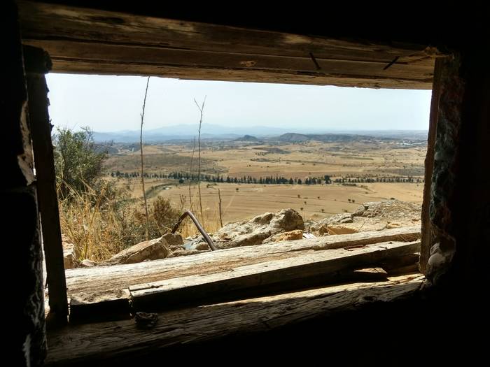
The view towards Louroujina from inside the bunker
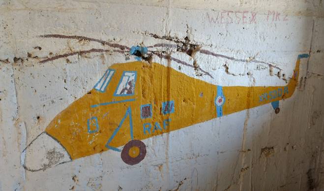
The internal walls of the bunker display some interesting artwork
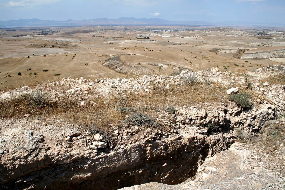
An extensive trench and bunker system runs around the edge of the high ground
In the middle of the Buffer Zone, the town of Athienou is marked in blue
In the video you can see the wide open spaces of the Buffer Zone, the tree-lined road leading the Athienou, the area around Louroujina, the Holy Cross Church near Lympia, the trench system on top of the ridge and, in the distance, the large town of Athienou
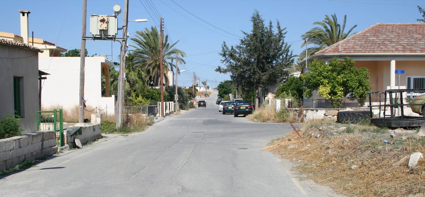
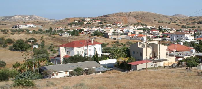
The town of Athienou is a mixture of large modern industrial estates and older village streets
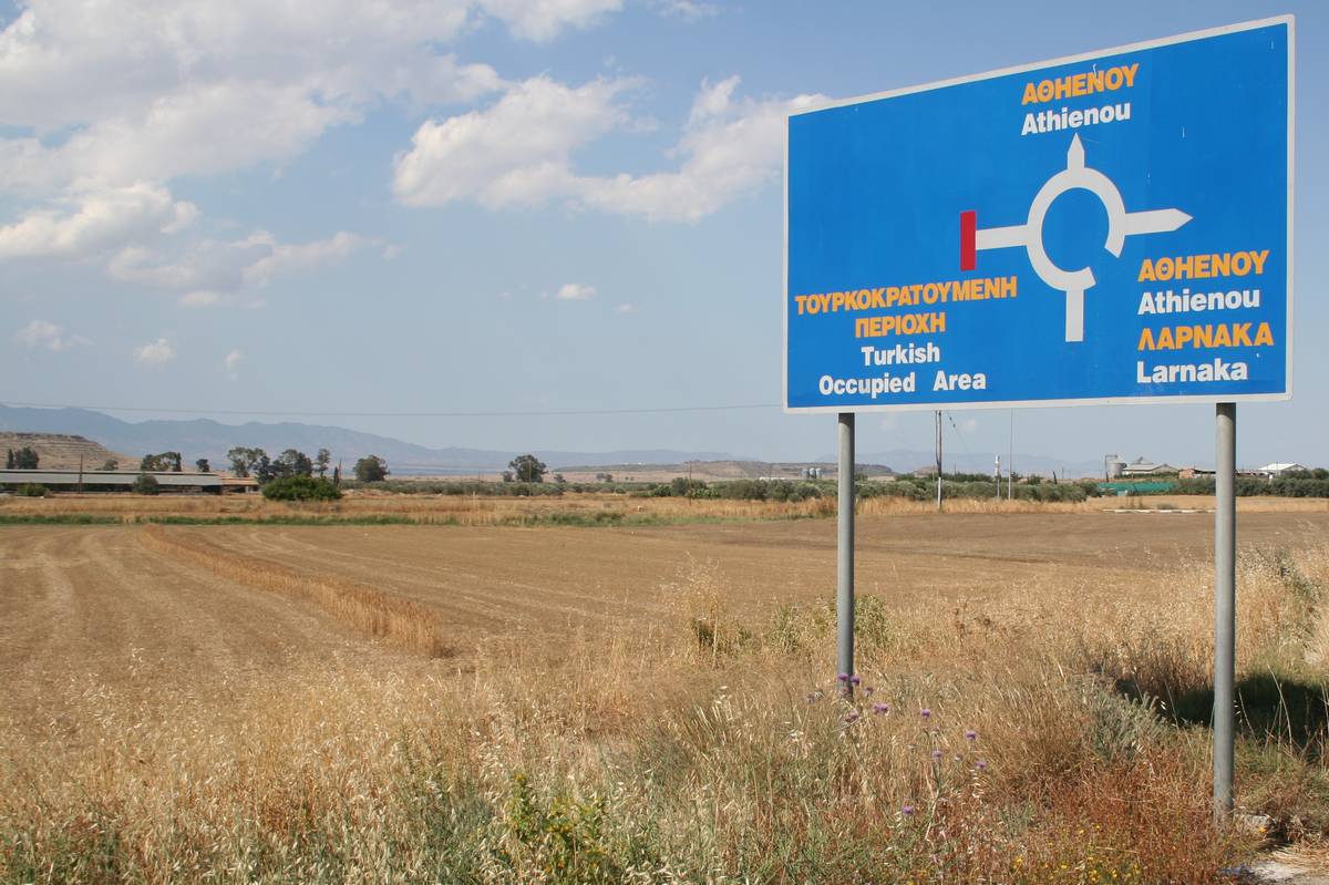
Athienou is now in the middle of the Buffer Zone and the the road signs indicate the northern (Turkish) boundary
In earlier years the town lay on the main road from Larnaca to Nicosia

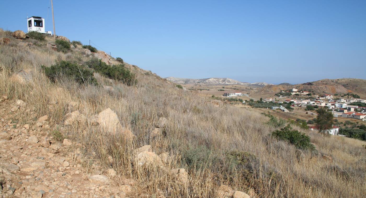
Agriculture continues until close to the Turkish lines where an UN OP watches over the area
Although this position is no longer permanently manned there is a large permanent base in Athienou itself

After Athienou, the Buffer Zone narrows and then opens out once more to surround the village of Troulli (marked in blue)
Looking into the Buffer Zone and the village of Troulli......it is interesting to note the proximity of the Buffer Zone's southern boundary to Larnaca (on the coast)
An Observation Point watched over this area where Turkish patrols frequently moved south until challenged by the UN
The village of Troulli is in the background
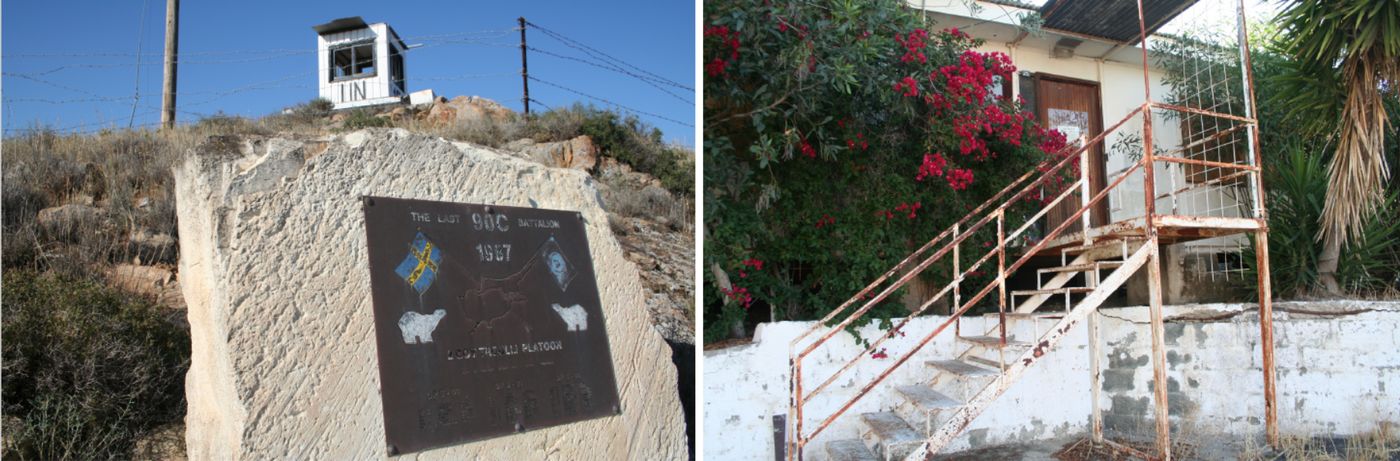
The last permanent presence was in 1987 when the OP and the village buildings were occupied by Swedish UN troops
The Buffer Zone continues east, crosses the high ground on the LHS of the picture and then reaches the boundary of the British ESBA
Note the faded UN-121 on the roof of the building in the foreground