From Filey Brigg to Spurn Point
The area covered by this guide begins south of Filey at Hunmanby Gap and finishes at Spurn Point.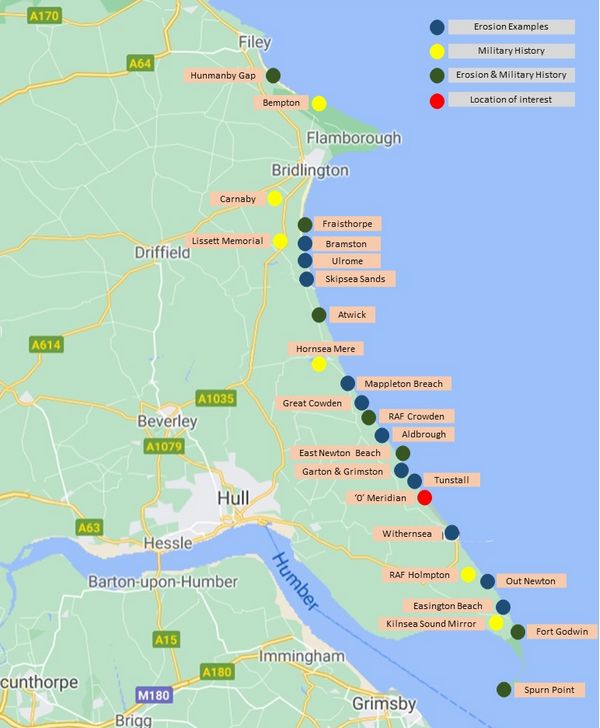
Although most locations described are on the coast, a number are a short distance inland.
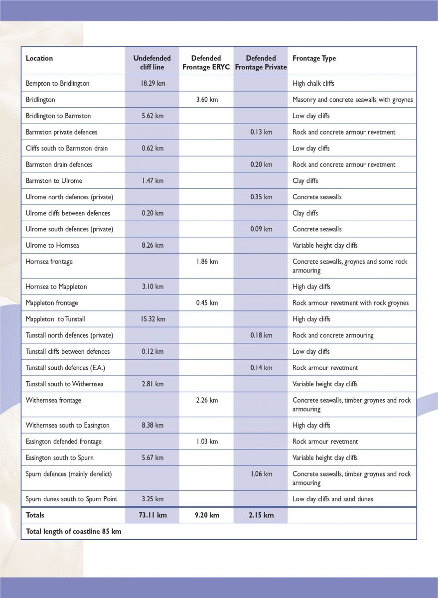
A detailed description of protected coastline built privately and by the Council.
Click the image to load a larger view (in a new window) or this link to download a document detailing the type and location of East Yorkshire's coastal defences (including the above chart).