The Formation of the East Coast
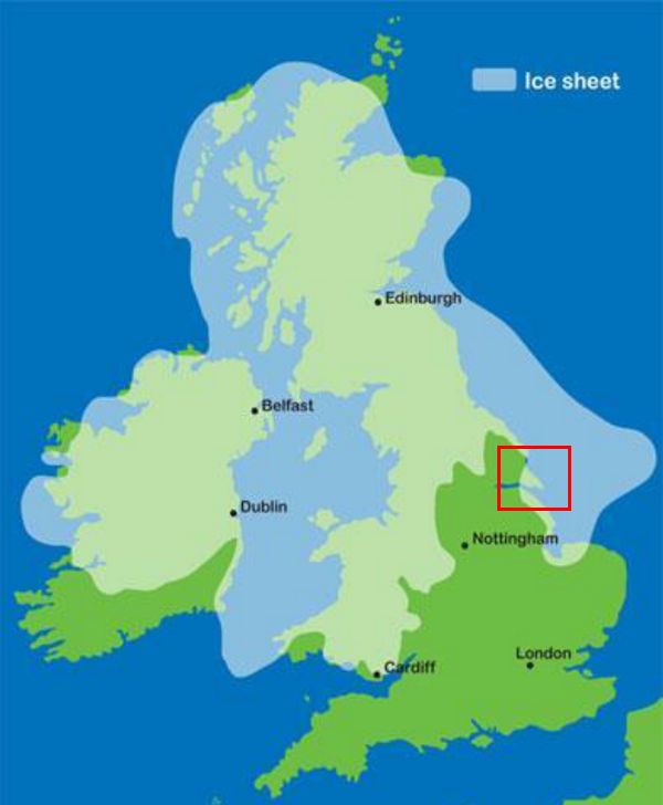
The future shape of Holderness can clearly be seen within the red square.
At the time of the last ice-age (12,000 years ago), this area was sea-bed under the icesheet.
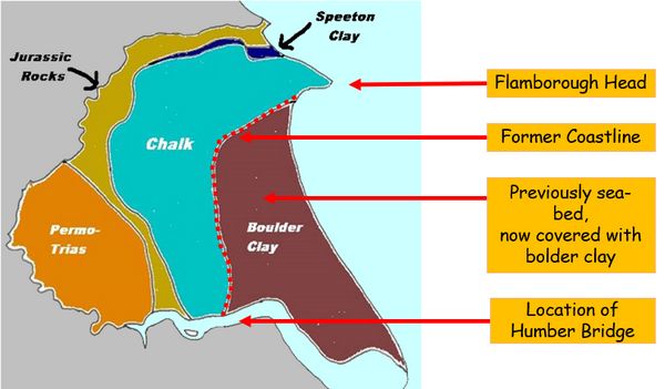
As the ice melted, vast quantities of bolder clay remained and the fragile (but fertile) land of Holderness was created.
The erosion of the new bolder clay coastline began immediately.
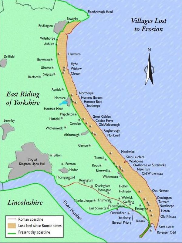
The distance between the coastline in Roman times and that of today is approximately 5km.
This was calculated by Ernest Romney Matthews, a civil engineer, in 1905.
Twenty-nine villages have been lost to the sea.
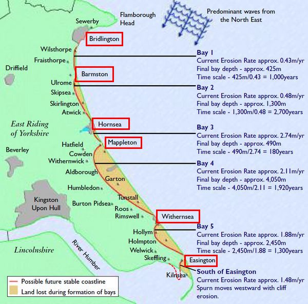
The defended frontages (marked by the red rectangles) will gradually project further seawards as the adjacent coastline recedes. These headlands will help to retain sand on the beach north of the protected area. Over time these sandy beaches will re-orientate themselves parallel to the incoming waves and form deep bays. At some stage these ‘stable’ beaches will prevent any further erosion.
The long term implications are reassuring although, in the short term, people will continue to lose their homes.