Inside the Louroujina Pocket
This page continues the journey along the Buffer Zone but, on this occasion, from the Turkish side of the line.
To understand the unusual nature of this location it is useful to view the map below with the Louroujina Pocket circled.
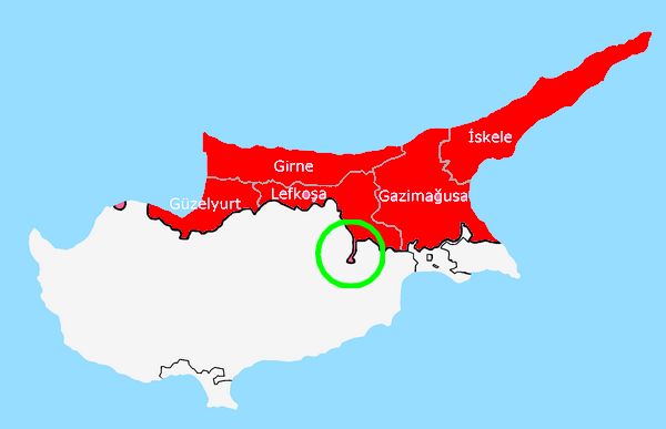
The occupation of Louroujina (Akincilar) at the base of the pocket created a deep salient with exposed flanks.
Louroujina/Akincilar was a mixed community until tensions created by the EOKA campaign (1955-59) led to the Greek Cypriot minority abandoning the village.
During the troubles of 1964, the village became an important reception centre for displaced Turkish Cypriots from nine outlying villages and the population grew to around 5000 inhabitants.
A number of the displaced Turkish Cypriots arrived from the village of Pyrogi (Pyroi)/Gaziler which sits astride the old Larnaca-Nicosia road a few miles north of Louroujina.
This was an area of great tension with several Greek Cypriot villages close to Akincilar.............Lympia to the south and Dali to the west. Additionally, the access road from the north went through two Greek Cypriot villages.....Tymbou & Pyrogi. This situation meant that a significant UN force was permanently stationed in Akincilar with the high ground surrounding the village continually observed and patrolled.
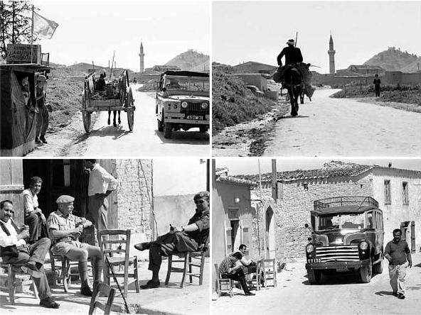
The above montage contains images which are the copyright of John Stæhr and his website........Image database - Pressphotos.
Permission has been requested to use these images.
They show the village in March 1965.
Following the second Turkish operation and the ceasefire agreed on the 16th August 1974, Turkish troops continued their advance towards Akincilar with the aim of including the village in the occupied area.
A fierce battle occurred at Pyrogi and the road between Nicosia and Larnaca was cut. Three Greek Cypriot National Guard tanks were captured and, to bolster the defences of Akincilar, two were placed on the ridge overlooking the village with a clear view of National Guard positions.
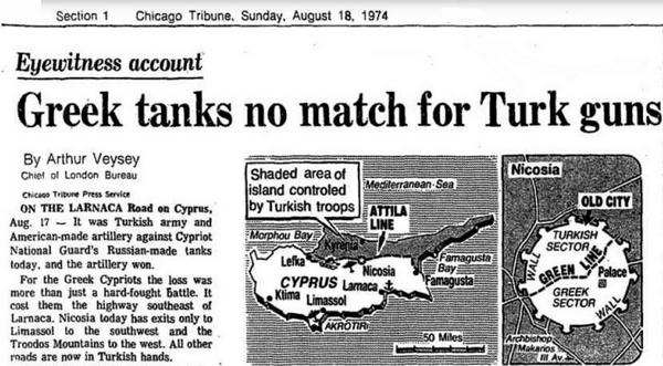
An eyewitness account of the battle in August 1974........the text should read "......the highway south east to Larnaca"
Click this link for the full eyewitness account (PDF in a new window)
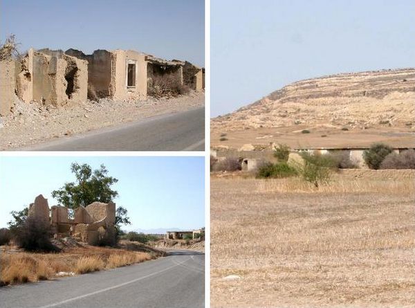
The remains of Pyrogi and the ridge overlooking the Larnaca-Nicosia road.
(Pyrogi was the site of a British Detention Camp during the EOKA campaign)
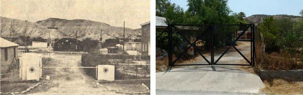
The village population declined over the next few years as the "pocket" was considered a closed military area making access difficult. The village of Tymbou/Kirklar, at the entrance to the salient, became a large Turkish military camp and only those with Northern Turkish Cypriot ID cards were allowed to pass through. It is reported that even Turkish Cypriots who lived in London and wished to visit relatives were denied access.
Following the expansion of Ercan Airport, a new road has been built which bypasses the Kirklar military camp and for the first time since 1974 visitor access to Akincilar is now possible.
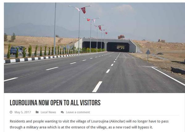
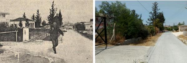
The wide dual carriageway and the bypass around the military camp at the beginning of the journey to Akıncılar is not indicative of the rest of the route.
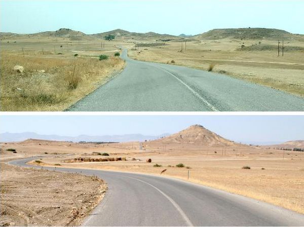
The same area, the top looking south and the bottom image looking north
The church of the Holy Cross above Lympia can be seen to the right of centre in the first image
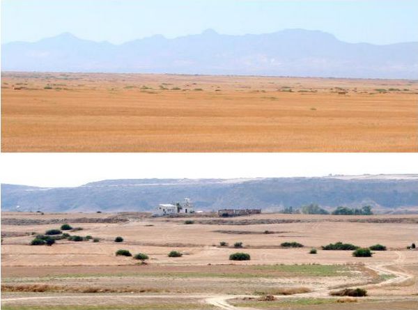
The tinder dry land bordering the road to Akincilar and a UN OP at a point where the Buffer Zone narrows.
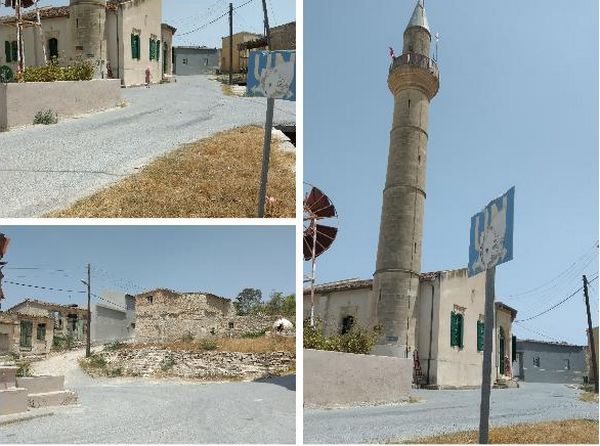
The village still has signs which remind you of the earlier UN presence
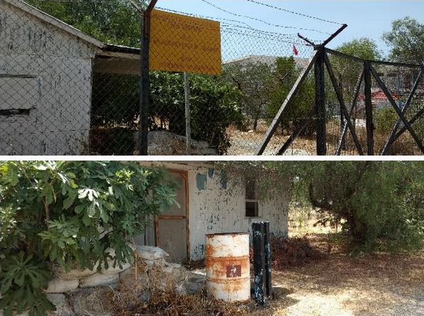
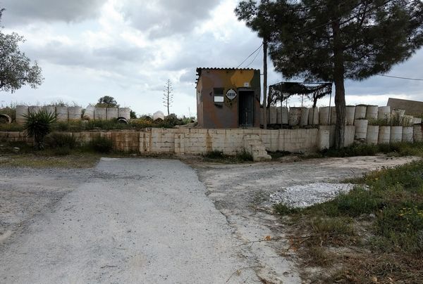
The UN camp at the southern end of the village is now locked and abandoned
Two "then & now" images of the UN camp in Akincilar
The "gritty" reminiscences of a Canadian UN soldier posted to Louroujina in 1974 can be read by following this link (opens in a new window)
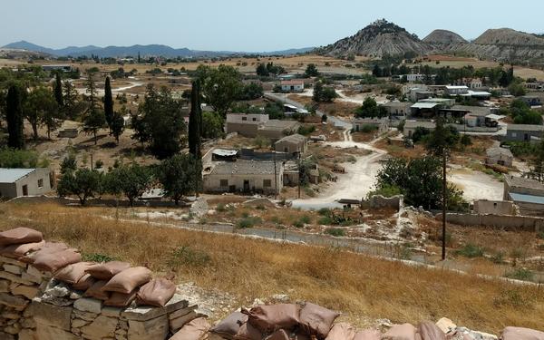
The view over the village from the "Command Centre" with the Holy Cross church (now a Turkish position) in the background
The village of Lympia is visible at the top left of the photograph
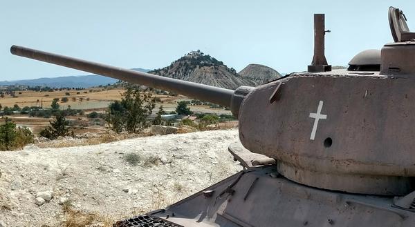
One of the captured T-34 National Guard tanks
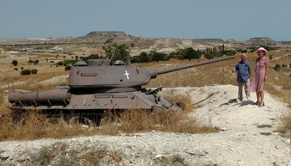
Our guide, Mustafa, photographed with the second tank (and my wife)
Mustafa was a London Cypriot who returned to his village after 53 years
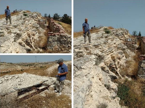
Mustafa showing us the "Command Centre" and firing positions
At the southern end of the village the main road to the Greek Cypriot town of Lympia has been blocked since 1974.
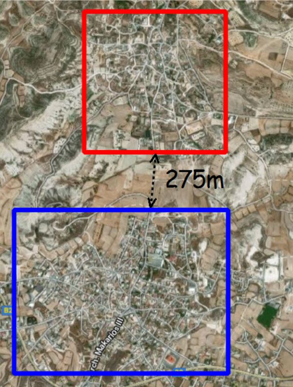
It is 275m from the roadblock in Akincilar across the Buffer Zone to the outskirts of Lympia but, currently a journey of 77km.
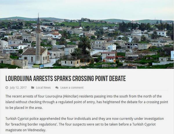
Although we were told that the villagers used a "secret road" to cross into the Greek Cypriot south, there were four arrests on the actual day of our visit.
An interesting film produced in January 2016 describing the lives, past & present, of three residents.
Unfortunately, the film makes no mention of the significant UN presence in the village between 1964-1974 and their role in maintaining the peace.