East Newton
This location is only accessible (July 2021) from the cliff path at Aldbrough Roadend.
I have included this location as an example of erosion over a period of time. There have been instances of sudden and dramatic losses of land but when the cliffs eroded back to this bunker, it took a number of years before it finally reached the beach.
Note: This structure was actually the generator building for a WW2 radar station and not a defensive bunker.
I am grateful to the owner of Urban Rim for the use of the earlier images on this page (link opens in a new window).
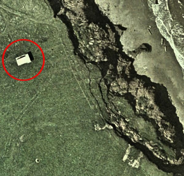
In a Google Map image from 2003, the building (used as an animal shelter) was 27m from the cliff edge.

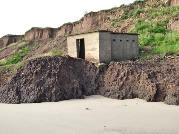
By 2012, the cliff edge had reached the old generator building (from a WW2 radar station).
By 2013, as the overhang increased, the building began a slow slide down the cliff face.
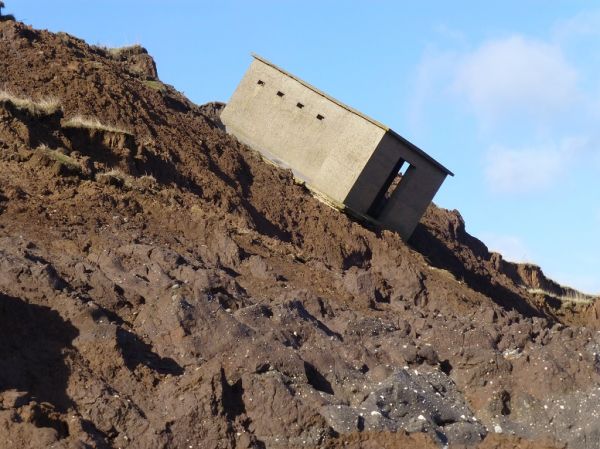
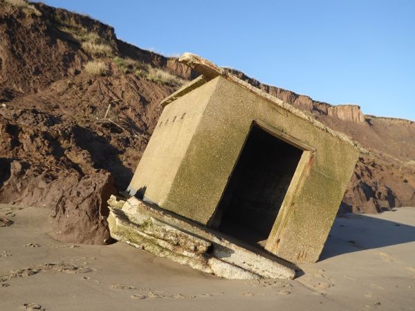
In 2014, the building had slid part way down the sloping boulder clay cliff.
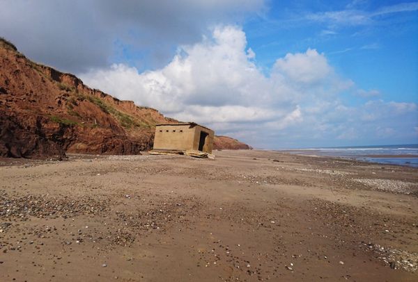
In 2017, almost as though this was its intended location, the bunker sits on a plateau just above the beach.
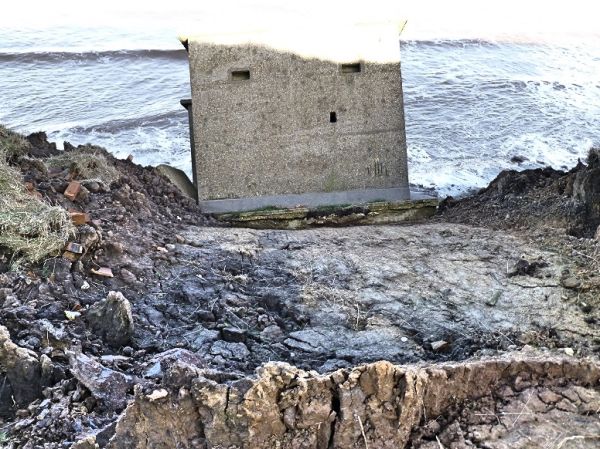
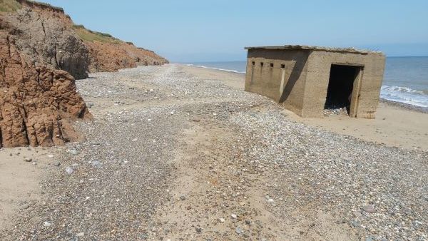
By 2019, the action of the waves had eroded the clay plateau and the bunker is now firmly embedded in the sand.
By 2020 the building is now clear of the bolder clay cliff. The waves will be able to wash around the rear, further eroding the cliff.
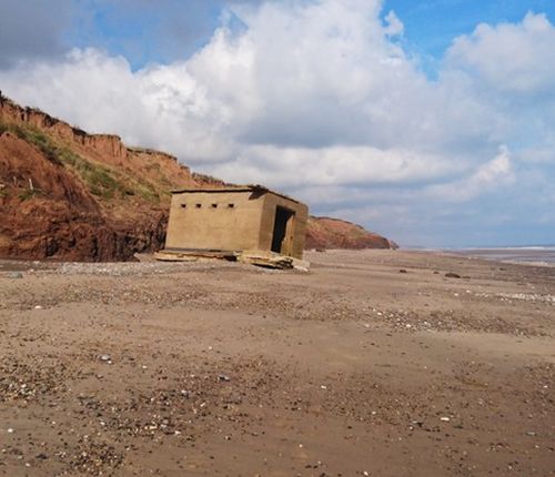
This final image was taken in July 2021. The building has been turned through 90º and is partly filled with pebbles.
The cliff line has receded significantly leaving the bunker firmly embedded in the sand and well clear of the cliff.
Even with two hours to high tide and a calm sea, the waves are wearing away to boulder clay cliffs.