Target York
York was not only a cultural target but also an important railway centre and home to several important war industries.
This target map, dated October 1941 concentrates on the railway objectives.
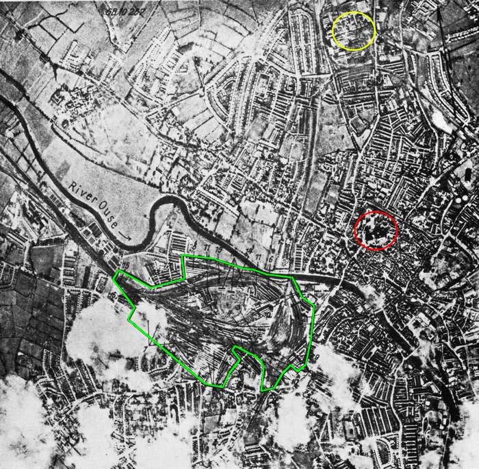
The red circle indicates York Minster and the yellow circle is the Rowntree's Factory. These locations were not identified as targets. The green area marks the railway targets (photo credit: unknown)
Click this link for a detailed description of the railway annotations
Unknown to the Germans (and many York residents) much of the Rowntree's factory in the north of the city had been put to new uses. Much of the office block on Haxby Road was given over to the Royal Army Pay Corps. The cream department was reorganised for the production of munitions, Ryvita and dried egg, while the gum department was converted into a secret fuse factory, named County Industries. Significant stocks of high explosives were stored on site.
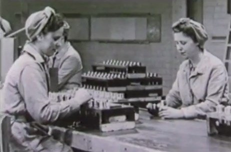
Workers preparing fuses at the Rowntree's factory (photo credit: still from 'The Longest Night' video)
The Terry's factory in the south of the city (close to the racecourse) was taken over by F Hills and Sons of Manchester as a shadow factory, to manufacturer and repair aircraft propeller blades.
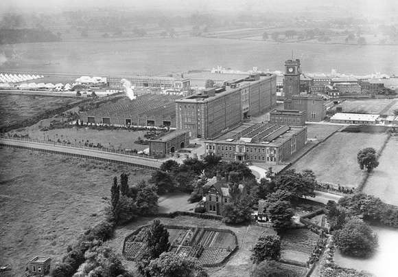
The Terry's factory outside York.....© English Heritage. Licensor www.rcahms.gov.uk
Cooke, Troughton and Simms made military binoculars, rangefinders and bombsights. They employed over 3,300 people during WW2.
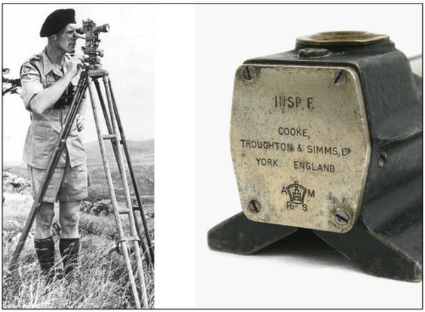
The military used a wide range of optical equipment made by this York firm
York railway station was used by large numbers of troop trains and important cargo (to support the Russians) was moved to Hull through York.
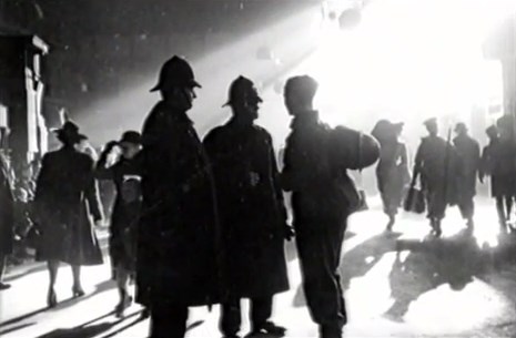
Police assist one of the many soldiers passing through York station.
(photo credit: still from 'The Longest Night' video)
York itself was the headquarters of the Northern Command. The city also contained the Depot of the West Yorkshire Regiment and was the centre for many military camps.
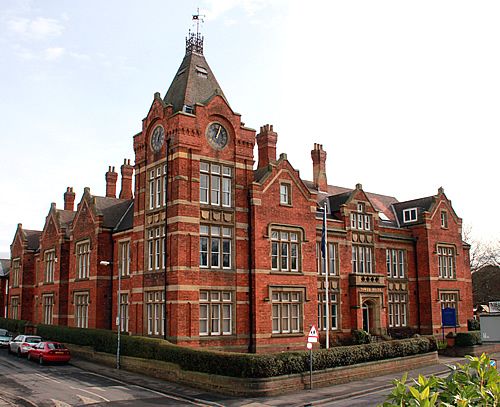
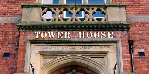
The former Headquarters Northern Command building on Fishergate.
(photo credit: Tower House Business Centre)
York was surrounded by air force stations, the closest being RAF Clifton. Between 1941-1943 this airfield, at the edge of York, was being developed with three concrete runways built to facilitate a Halifax heavy bomber repair unit (No.87 Maintenance Unit) and to allow faster and more modern aircraft types to use the airfield.
The main gate of the former RAF Clifton....previously York Municipal Aerodrome.
At the time of the raid, No.4 Squadron were located at this airfield. This squadron was initially equipped with the Lysander and acted in an army co-operation role. Later in their stay at RAF Clifton they were equipped with more high performance aircraft and operated as a fighter-reconnaissance Unit.
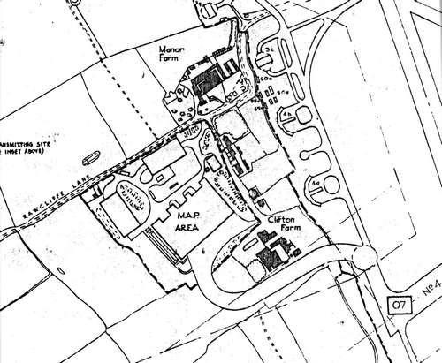
In July 1941, the MAP (Ministry of Aircraft Production) facility opened off Rawcliffe Lane (see map above) and was linked to the runway via a curving taxiway.
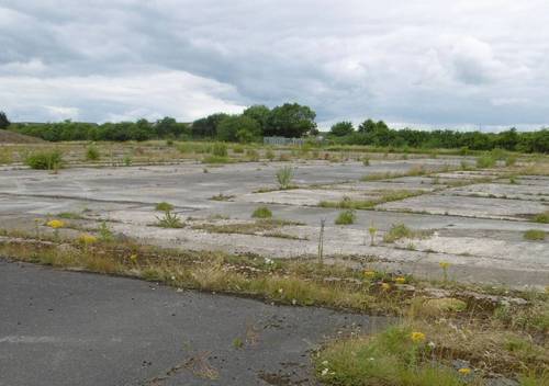
The image above shows one of the dispersal areas (NE of Clifton Farm on the map) with the MAP buildings in the background.
Picture courtesy of Paul Francis from the Airfield Information Exchange Forum.
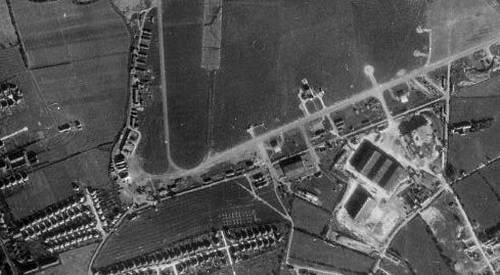
In September 1942 an extension to the facilities was commissioned on the southern edge of the airfield. At its height, the Civilian Repair Unit, known as 'The Yard', employed 2700 people.
The large Handley Page hangers can be seen in the bottom right corner of the above photograph of RAF Clifton.
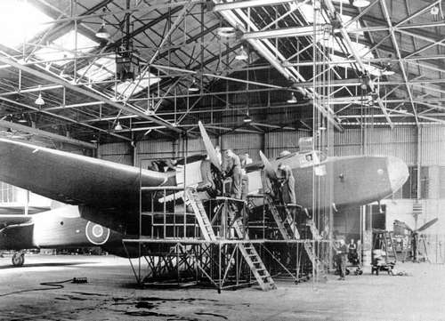
The finishing touches being put to a repaired Halifax bomber in the Civilian Repair Unit.
(Picture reproduced courtesy of The Press, York......www.thepress.co.uk)
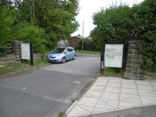
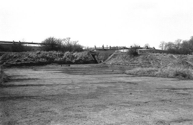
The hangers at the south of the airfield are now gone but the parking area and access route to the airfield still remain.
(July 2015)
For more images and information about York's Civilian Repair Units please click this link.