The Berlin Wall Develops
With each successful breach of the border (both around Berlin & the Inner German Border) the defences in that area were immediately improved.
Over the years, these improvements were 'rolled out' along the whole length of the Berlin Wall / IGB.
By 1975, both borders had developed and deepened into what the East German leadership termed the "modern frontier" (die moderne Grenze).
''Security has become so tight that it is virtually only madmen who attempt to cross directly from East to West.'' - Rainer Hildebrandt (human rights activist and founder of the Checkpoint Charlie Museum).

The Berlin Wall changed from a fence to cement blocks, to strengthened concrete panels to the 3.6m tall concrete sections with the 'roll-top' pipe
Click the image or this link for a larger version (opens in a new window)
Most importantly, in June 1962, a second, parallel fence/wall was built approximately 100 metres back into East Berlin territory.
Any houses (or churches) in the area between the fences were demolished and the inhabitants relocated.
This clear zone became known as the death strip and was covered with raked sand or gravel, making footprints easy to notice,
The strip had no cover but offered clear fields of fire for the Wall guards.

From a single fence to a sophisticated system - a row of houses are demolished to create the death strip along Bernauer Straße
Click the above image or this link for a larger version (opens in a new window)

The Church of Reconciliation lasted longer than many buildings that were in the 'death strip'.......it was destroyed only in 1985 to 'increase the security, order and cleanliness on the state border with West Berlin’

A typical 'modern' section of the Berlin Wall. West Berlin is to the left with the viewing platform.
The entire length of the border around Berlin was brightly floodlit

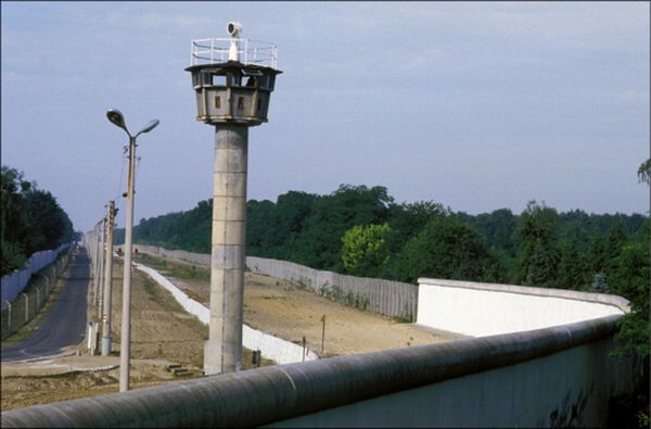
From a viewing platform in Berlin.........what it looked like in real life.

From another viewing platform.........note that the smooth "roll top" to the wall (a tube to make crossing more difficult) was only added to the section through the middle of Berlin and at certain locations around Berlin. The white wall in the centre of the strip is the face of the anti-vehicle ditch.

An excellent summary of the Berlin Wall 'system' with interesting statistics
Click the image or this link for a larger version (opens in a new window)
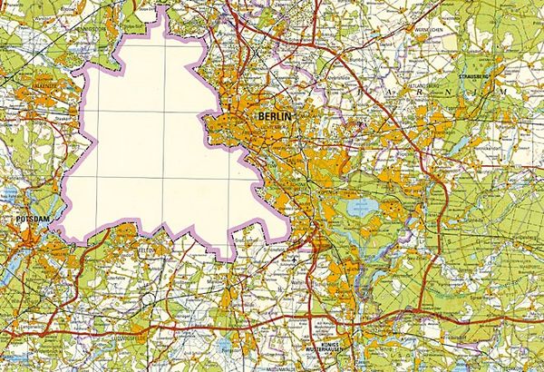
Not only was the population physically separated but even mapmaking emphasised only one side of the border.

The famous 1988 map of Berlin as published by the DDR authorities