Skipsea Sands
To explore the whole of this area you need to approach from two different directions.
The eroded road is approached through Ulrome on Sand Lane. Make a right turn at the end along Southfield Lane.
Park at some point before the concrete barrier and then walk south towards Skipsea Sands.
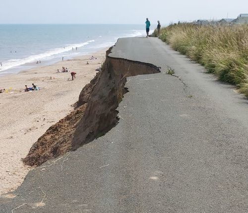
Southfield Lane comes to a dramatic end.
It is interesting to note that until a few years ago this was the bus route between Ulrome and Skipsea Sands.
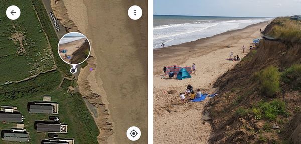
The GPS data of this photograph shows the location as just adjacent to the caravan site.
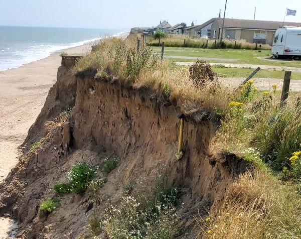
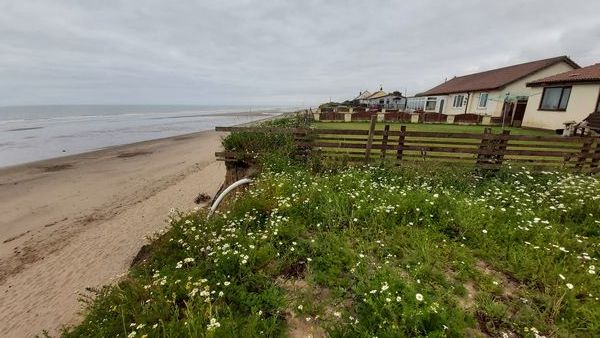
Looking to the south, the windbreak on the beach shows the position of the former Cliff Top Farm.
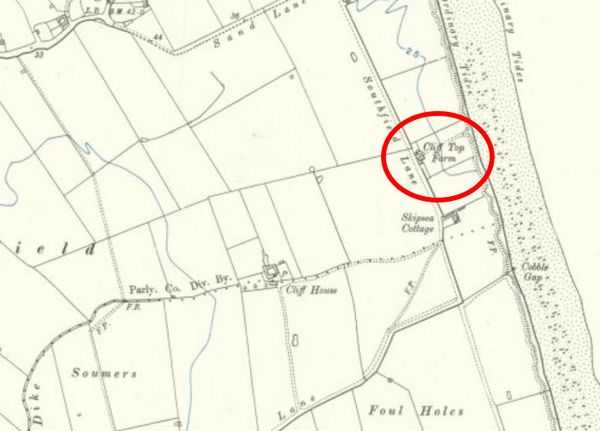
Cliff Top Farm is marked on this early 20th century map.
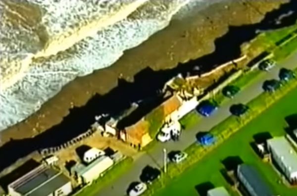
Click the image above to view the sad story of Cliff Top Farm's final residents.
The first 8:15m of the video tell the story.........opens in a new window.
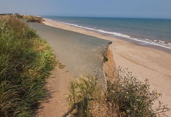
From the end of the road, you can continue a short distance along the cliff edge until you can go no further.
The buildings in the background are Skipsea Sands.
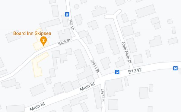
To reach Skipsea Sands you need to return to your car and drive to Skipsea village. Turn off Main Street along Cross Street and then follow Mill Lane.
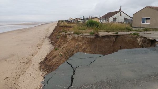
The road comes to an end near Crossways Fish Shop and a deserted Amusement Arcade.
In the distance are several of the 25 homes at great risk of collapsing into the sea.
The risk to these homes is obvious......only the time scale is unknown.
This animation shows the difference between a Victorian and present day map.
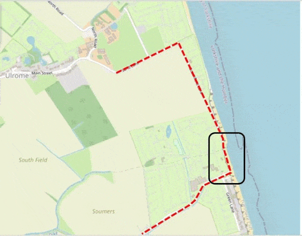
The marked section shows the area around the amusement arcade and the top of the threatened street (Green Lane).
The image pauses at the beginning and end of each animation.

Click the image above to read the full article (opens in a new window).