Withernsea

The map marker indicates a small plaque that perfectly expresses the changes brought about by erosion over the centuries.
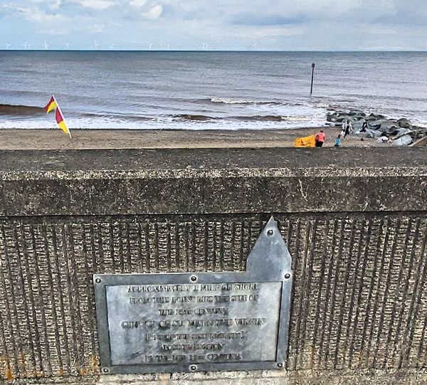
The plaque reads......."Approximately one mile offshore from this point lies the site of the 13th century church St Mary the Virgin (one of the sisterkirkes) lost to erosion by the mid 15th century".
The 'sisterkirkes' are explained at Location 2 on the town tourist map (opens in a new window)
Over the years, Withernsea had a series of promenades and sea defences built, extended and reinforced .......currently just over 2km in length.

Tthe original concrete defences of the Central Promenade are now reinforced with rock armour.
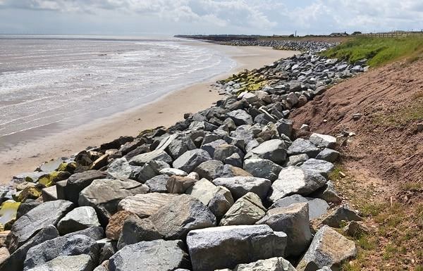
The view looking south from the end of the South Promenade. Additional defences are required due to the increased rate of erosion in this area.
Withernsea Lighthouse is one of the few lighthouses built inland. Curently, a significant part of the town is between the lighthouse and the coast. However, when it was first built in 1892 (because of the high number of shipwrecks in the area) there were only sand dunes in front.

The location of the lighthouse in relation to the coast.

An early image of the lighthouse with some new development.
The inland location was chosen because of the significant amount of erosion along this stretch of coastline and the desire to "future-proof" the structure. As it turned out, significant sea defences eliminated most of the erosion and the lighthouse found itself marooned inland.

For more information about the lighthouse click the image above or this link (website opens in a new window).
![]()
The 'Withernsea in Pictures' website has an excellent collection of images.
Click the image above or this link (website opens in a new window).
![]()
This website displays some spectacular images of the effects of erorion and the scale of the new coastal defences.
Click the image above or this link (website opens in a new window).