Ulrome

Approach this location along Sands Lane and park at the end of the road or along Southfield Lane.
Note that you can explore part of the Skipsea Sands erosion story from this location.

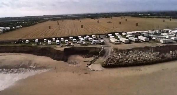
A drone image of the privately financed coastal defences built to protect the Holiday Camp above Galleon Beach.
This image (courtesy of UrbanRim) was taken in December 2013 shows the size and range of the defences.
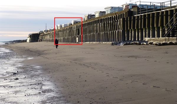
The marked area is where the defences will crumble.

A few days later, viewing the section marked above, the December storms have broken the defences.
This photo is © Tracey Anne Taylor (cc-by-sa/2.0)

Another drone image showing the concrete cylinders which made up the defensive wall.
It is interesting to note the massively increased erosion immediately to the left (downcurrent) of the ramp built to access the beach.....an example of outflanking.

The crenulated bay south of Ulrome created by the Terminal Groyne Effect (TGE) of the defences.
In 2015, the local council issued a demolition order and the remaining defences were removed.
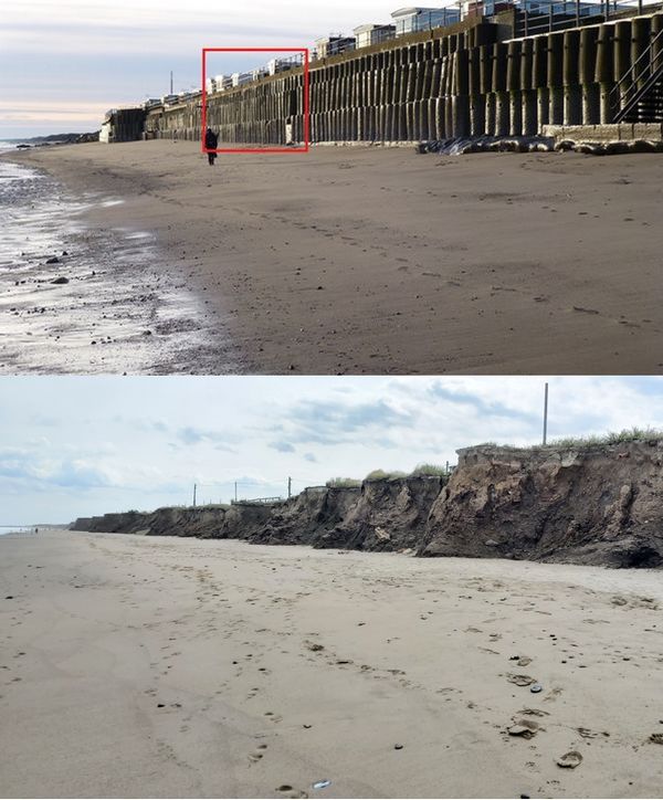
Ulrome beach before and after the defences were removed.

30mins after high tide and the sky, sea and beach display a wonderful range of colours.