The Second Operation
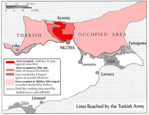
A second round of talks was agreed to begin on the 8th August 1974. There were immediate problems.........the Greek side would not negotiate unless Turkish forces ceased violating the ceasefire and Turkey would not negotiate unless Greece accepted the principle of an autonomous region for the Turkish Cypriots.Note: The diary of a British airline pilot living in Kyrenia gave first hand reports of Turkish advances and the constant flow of Turkish reinforcements during the ceasefire period.
By early August the UN had only been party to the buffer zone discussions and the zone had yet to be established.
The talks officially broke down at 02:20hrs on the 14th August 1974 and, two hours later, the Turkish forces broke out from their earlier positions and began the second phase of their invasion.
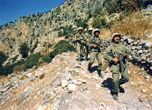
Turkish troops advance through the Pentadaktylos mountain range
Turkish forces advanced on several fronts and, over the next two days, reached Morphou & Lefka in the west and the Turkish quarter of Famagusta in the east.
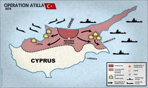
A map of the Turkish intervention (UN term) from the military museum near Kyrenia......not geographically 100% accurate
The advance was initially surprisingly slow........this was not due to especially stubborn resistance but, by making their preparations obvious, most Greek Cypriots in the line of advance would leave their villages. In this way the logistical problems created by large numbers of refugees would be avoided.
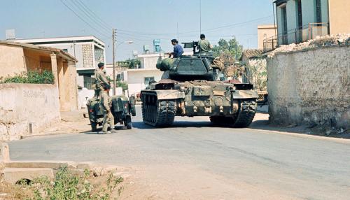
A Turkish tank moves through an abandoned Greek Cypriot village
Turkish Cypriot villages along the line of advance eagerly awaited the advancing Turkish army.
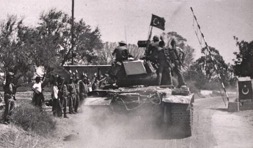
Turkish armour is welcomed by Turkish Cypriot Fighters and villagers at an unknown location
The Turkish Cypriots of Lefka were jubliant to see the Turkish army reach their town
To the west of Lefka there was a number of villages and a twisty mountainous road that led to the Kokkina Enclave (scene of serious conflict in August 1964). Unlike most of the recent advances this was certainly not tank country and progress was extremely difficult.

The map above shows the western edge of the Turkish advance
Other villages, either Turkish Cypriot, Greek Cypriot, mixed or previously abandoned, are marked
As can be seen, Kokkina remains an isolate enclave
Click the map or this link for a larger version (in a new window)
By the 15th August 1974 Turkish armour had reached Bogaz (on the east coast north of Famagusta). Several tanks moved south and others continued into the Karpas (Panhandle).
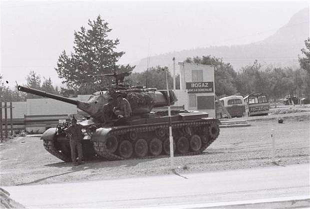
A Turkish tank outside Bogaz on the evening of the 15th August 1974
Additional images of the Second Operation can be seen by clicking this link (opens in a new window).
There were some tense scenes at the northern edge of the Eastern Sovereign Base Area when several tank shells were fired into the Base.
Speedy negotiations and some "navigational advice" ensured that there would be no repeat.
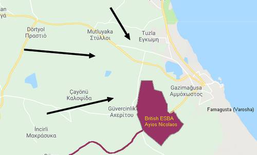
Without modern navigational aids it is clear how Turkish armour might unintentionally approach the boundary of the ESBA
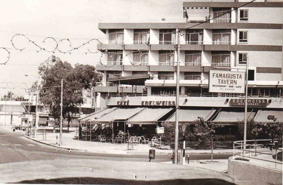
The tourist section of Famagusta, Varosha, was subjected to numerous air attacks between the 14th-16th August 1974 and the residents abandoned the city to seek refuge in the nearby Sovereign Base area.
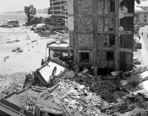
Damaged buildings close to the Famagusta tourist beach caused by Turkish airstrikes
The capture of Varosha was not included in the Turkish plans but when the army arrived and found the town had been abandoned, it occupied the area.
Note: This area is still abandoned and sealed off with no civilian access; only Turkish Military and UN access is allowed. A large number of websites show images of the now infamous "Famagusta Ghost Town" which can be found using a simple Google search.
A typical scene awaiting the Turkish army as they entered Varosha......empty streets and deserted buildings
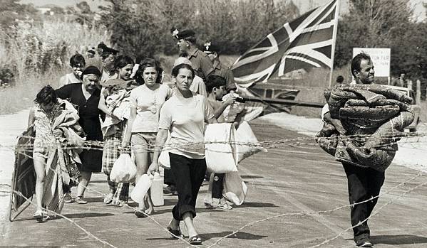
The population of this popular tourist resort find refuge in the Eastern Sovereign Base Area
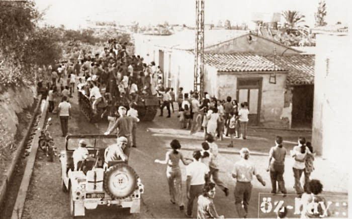
The Turkish Cypriots who, for the last month, had been under siege in the walled city of Famagusta (Mağusa) came out in force to welcome the Turkish Army.
The roads were strewn with flowers as a welcome.

The magnificent Venetian walls of old Famagusta can be seen in the background of this photograph
A ceasefire was agreed from 18:00hrs on the 16th August 1974 when the Turkish forces had completed their campaign objectives. However, for several days after the ceasefire the Turkish army continued to take new territory.
The large Turkish Cypriot village of Louroujina was reached creating a narrow salient and Turkish forces pushed right up to the boundary of the Eastern Sovereign Base Area. Further small gains were made in the west but the army was unable to reach the Turkish Cypriot enclave of Kokkina (to the west of Lefka).
By the time of the 'final push', Turkey occupied 36.3% of the island.
This map shows the areas occupied at each stage during the invasion right up to the final push towards isolated villages after the final ceasefire
Click this link for a larger version (which opens in a new window)